AEROS MH-1: see the first images captured by the Portuguese satellite
The second Portuguese satellite in space has captured images of various locations on the planet, but this is just a sign of life from the AEROS MH-1. Over the next few years, many more images are expected that will contribute to the study of the oceans.
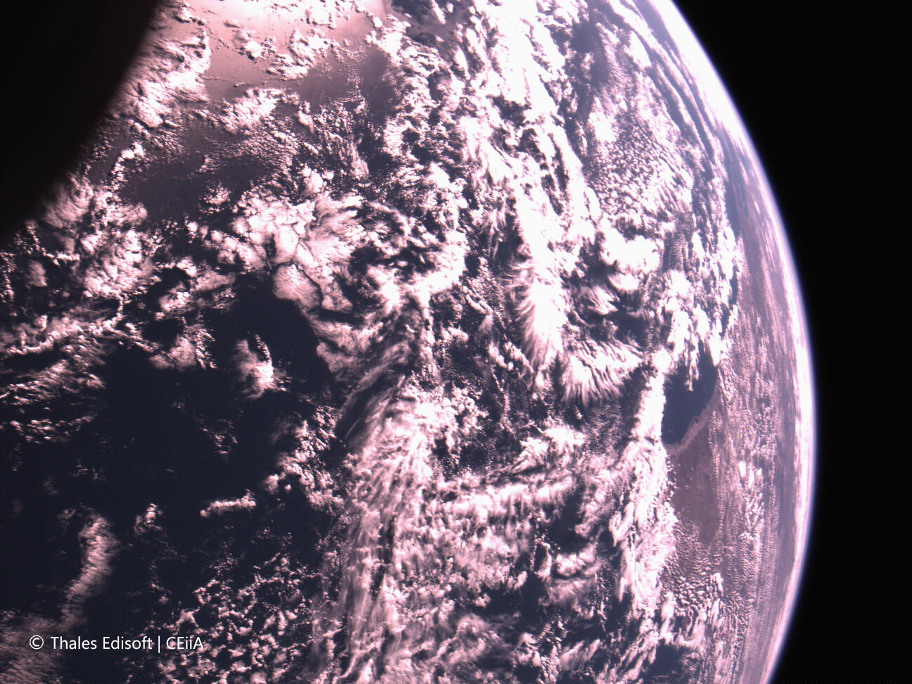
Three decades later, a Portuguese satellite has been launched into space and Is taking pictures of our planet. The AEROS MH-1, launched last March, sent its first images of French Polynesia, Canada’s Great Bear Lake, and western Australia.
Western Australia. © Thales Edisoft/ CEiiA
The news was announced this Tuesday by Thales Edisoft Portugal and CEiiA (Centre for Engineering and Product Development), who head the consortium responsible for the satellite’s development and operation. Although the Atlantic bathes none of the locations captured, the images serve as the first sign of life from the satellite. They were captured by its low-resolution camera, whose function is the orientation and positioning of the AEROS MH-1.
After the launch, the satellite was placed into a polar orbit at about 510 kilometers in altitude, traveling at a speed of approximately 28,000 kilometers per hour. At that time, the satellite entered the LEOP (Launch and Early Orbit Phase), crucial for “orbit stabilization,” but also for “testing communication systems with ground stations and calibrating the payloads,” that is, its sensors. This phase’s first part completion included collecting these images and the “assessment of the operational status and integrity of the satellite and initial testing of the onboard sensors,” explains Pedro Nunes, communication director at Thales Edisoft Portugal.
Over the next few years, the satellite’s data will enable “analysis of the marine ecosystem and climatic patterns” of the oceans, particularly the Atlantic. The AEROS MH-1 is equipped with a hyperspectral camera and software capable of “analyzing the color of the ocean, identifying ocean fronts, measuring chlorophyll,” or “performing atmospheric corrections,” for example. The camera was developed by the Portuguese company SpinWorks, one of the consortium’s partners. “The details about the potential of the hyperspectral camera are not yet known, as a low-resolution camera captured these images. However, we can expect a resolution of about 55 meters per pixel from the hyperspectral camera,” adds Pedro Nunes.

French Polynesia. © Thales Edisoft/ CEiiA
The satellite also has an integrated receiver for marine animal tags, provided by dstelecom. The information collected by the receiver will allow the study of “temperature, humidity, depth, light intensity, and the movements of marine animals through sensors,” adds the communication director of Thales Edisoft Portugal.
The company was responsible for the software development, post-launch verifications, and the first operational cycle through the Santa Maria Teleport in the Azores. CEiiA oversaw the satellite’s integration, from its conception to its launch and operation.
The AEROS MH-1 was launched on the night of 4th March aboard the SpaceX Falcon 9 rocket. It is the second Portuguese satellite in orbit, succeeding the pioneering PoSAT-1, launched in 1993. The Teleport’s antennas will receive the satellite’s data and ensure all command and control communications. The data processing is done in Matosinhos, where CEiiA is based.
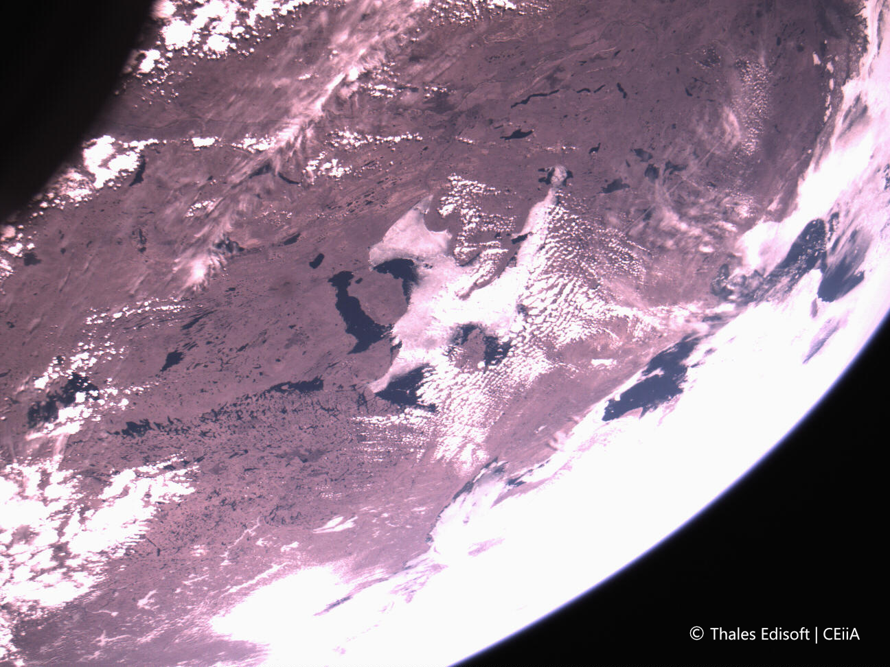
Canada’s Great Bear Lake. © Thales Edisoft/ CEiiA
The satellite was developed and built in Portugal in partnership with the Massachusetts Institute of Technology (MIT). Led by Thales Edisoft Portugal in collaboration with CEiiA, the AEROS MH-1 project involved a consortium of 12 entities, including SpinWorks and dstelecom, as well as academia, represented by the Universities of Minho, Porto, and Algarve, the Instituto Superior Técnico (IST), CoLab + Atlantic, Okeanos, and the Air Centre.
